Pacheco Falls

Hike Review
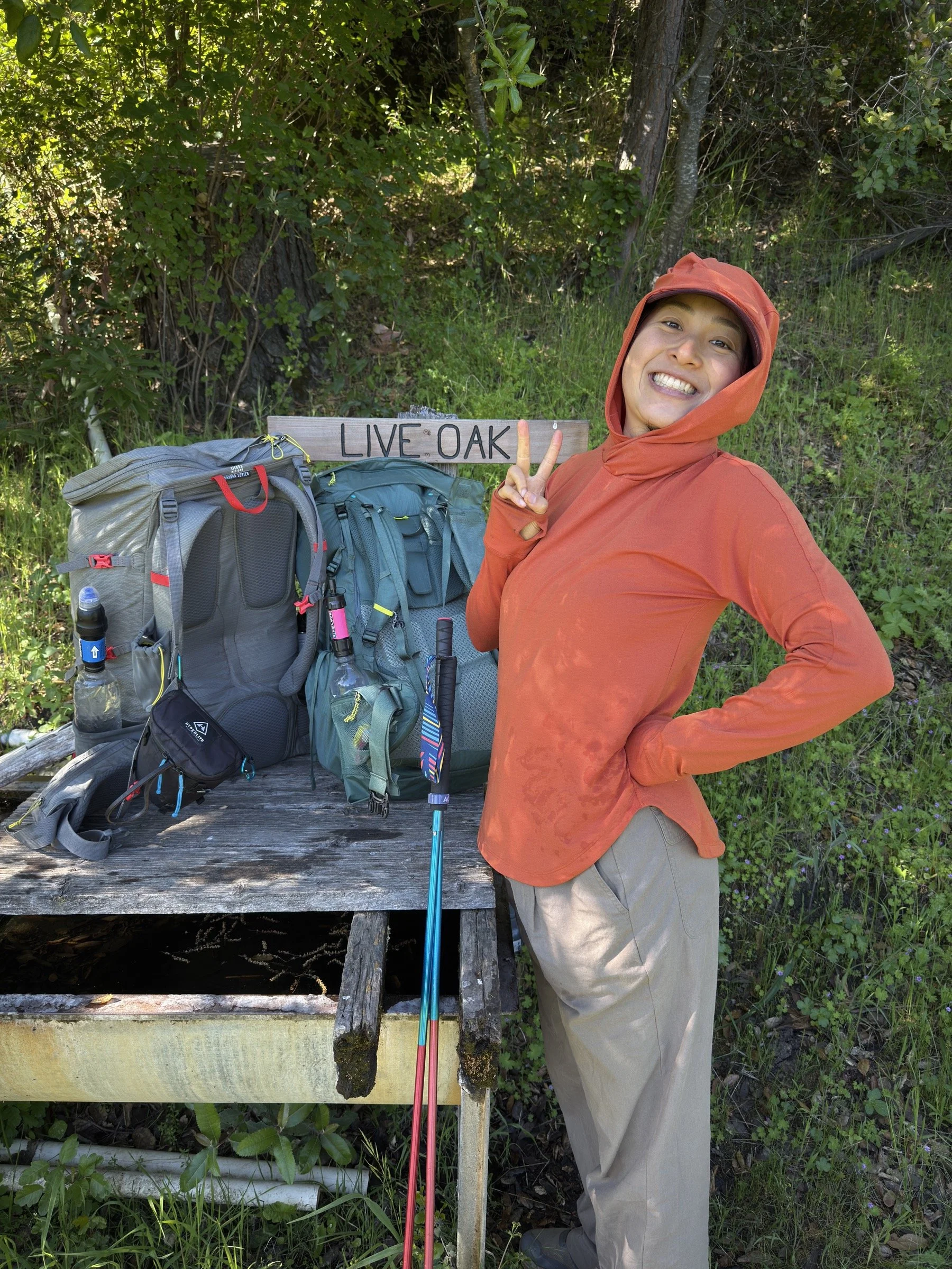
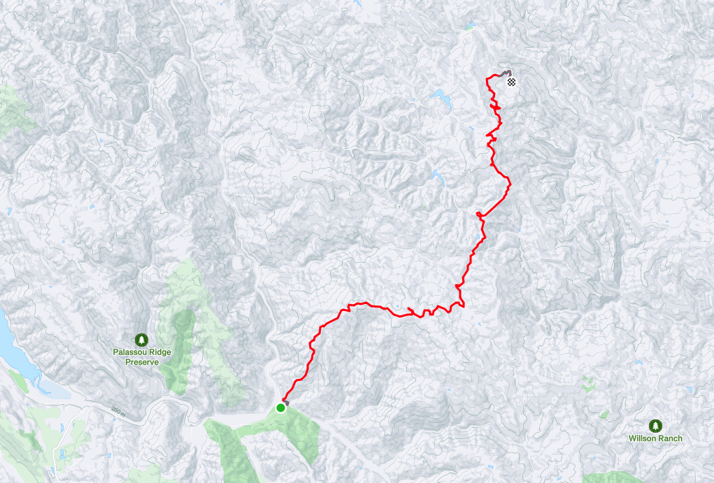
After parking at the Hunting Hollow Trailhead at Henry Coe State Park, we hiked the Steer Ridge Trail, Steer Ridge Road, Serpentine Trail, Grizzly Gulch Trail, Deer Logic Trail, Wagon Road, Live Oak Spring Trail, and Pacheco Falls Trail, where we set up camp near Wood Duck Pond.
The next day. We hiked out by hiking Pacheco Falls Trail, Live Oak Spring Trail, Fish & Game Trail, Coit Road, Kelly Lake Trail, Wasno Road, Dexter Trail, Grizzly Gulch Trail, and Gilroy Hot Springs Road.
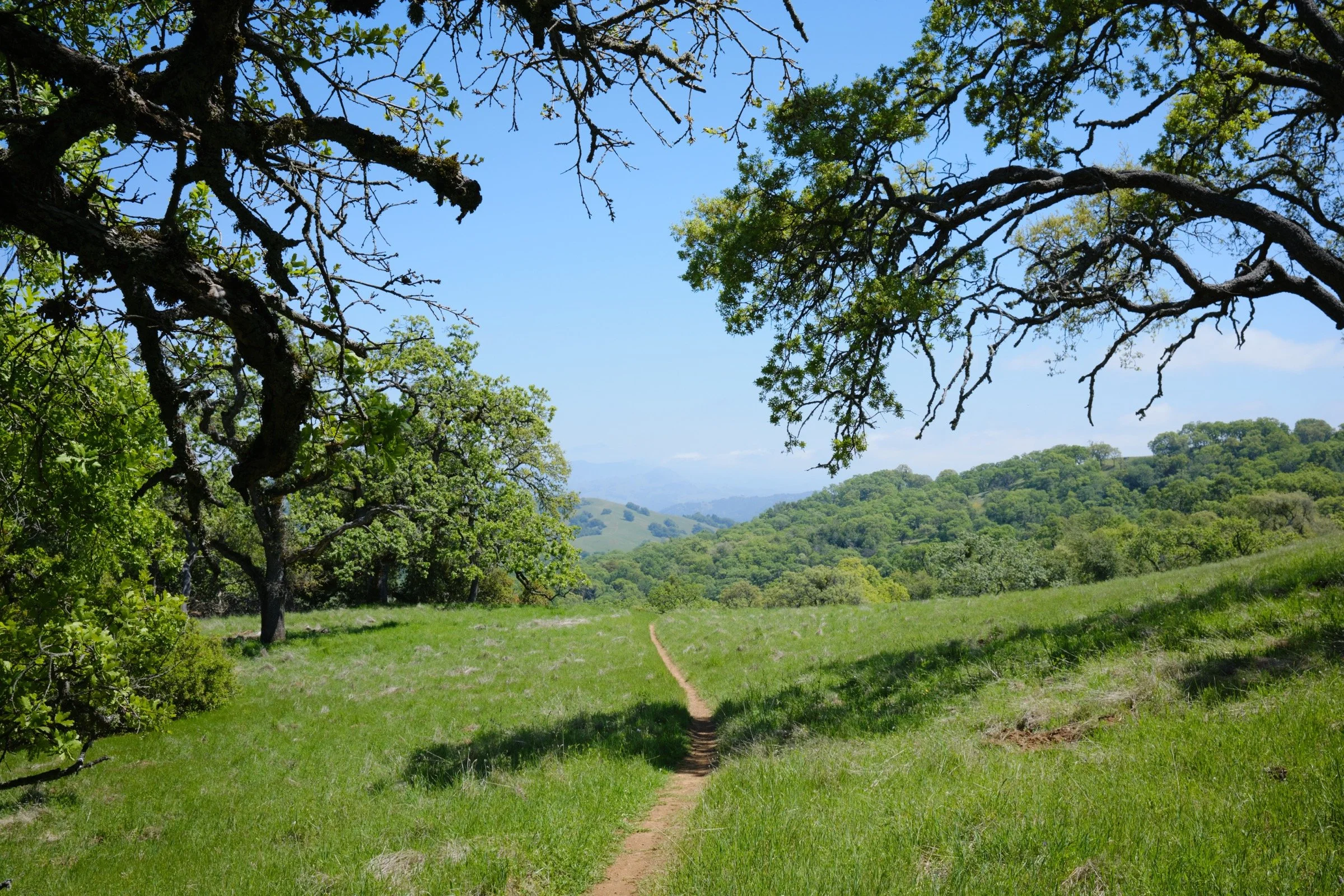
The prettiest trails were Steer Ridge Trail/Road for its vast views of the surroundings, Deer Logic Trail for the number of trees and flowers, and Grizzly Gulch Trail for hillside views.
With a few exceptions, the roads were double-track hard-packed dirt roads and the trails were single-track hard-packed dirt trails. All the trails we walked weren’t too dusty at all, which was a bonus.
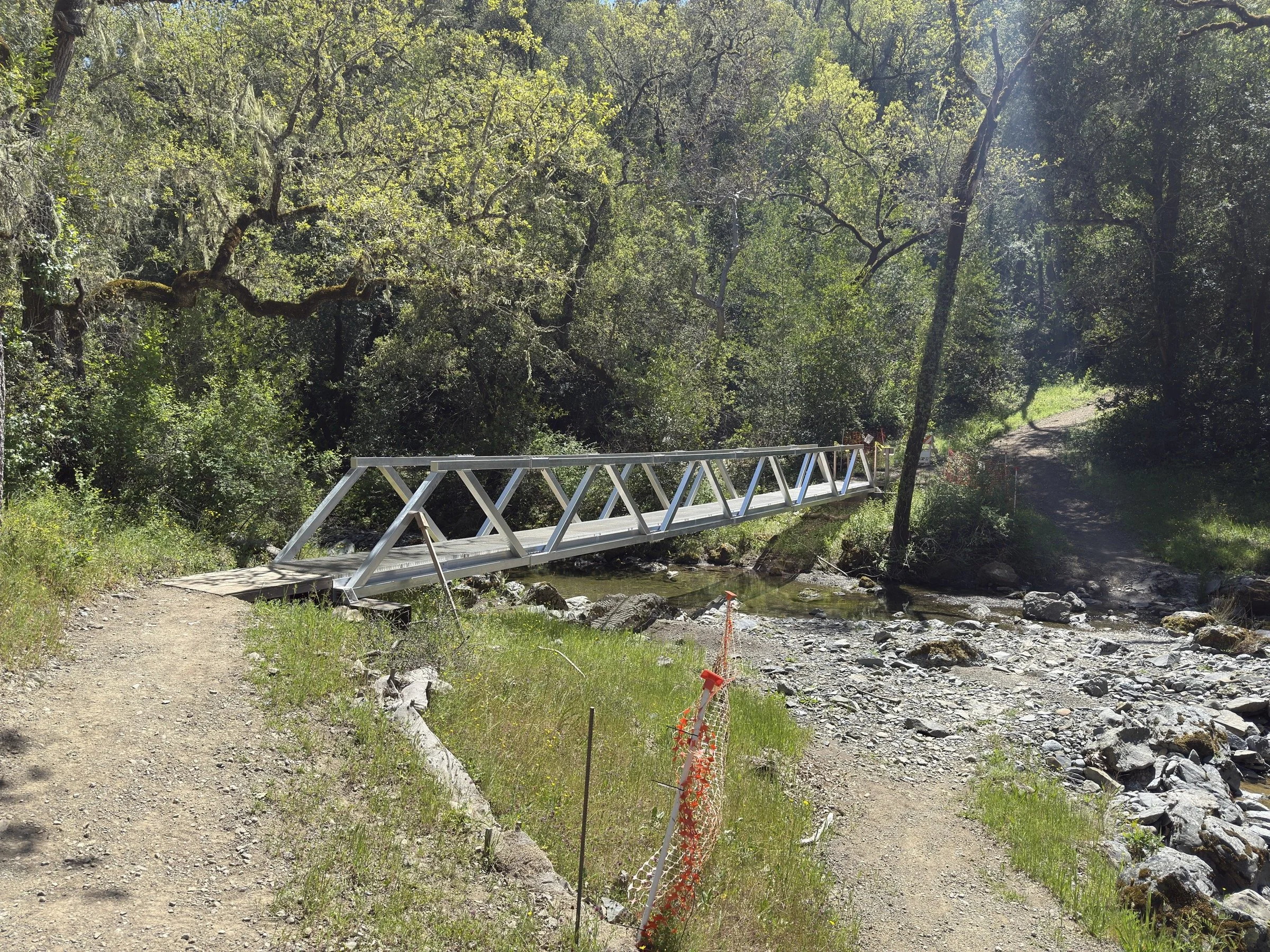
There was a lot of construction happening on Grizzly Gulch Trail with a new bridge being put in and some switchback trails being put in on the steepest (and slipperiest) parts.
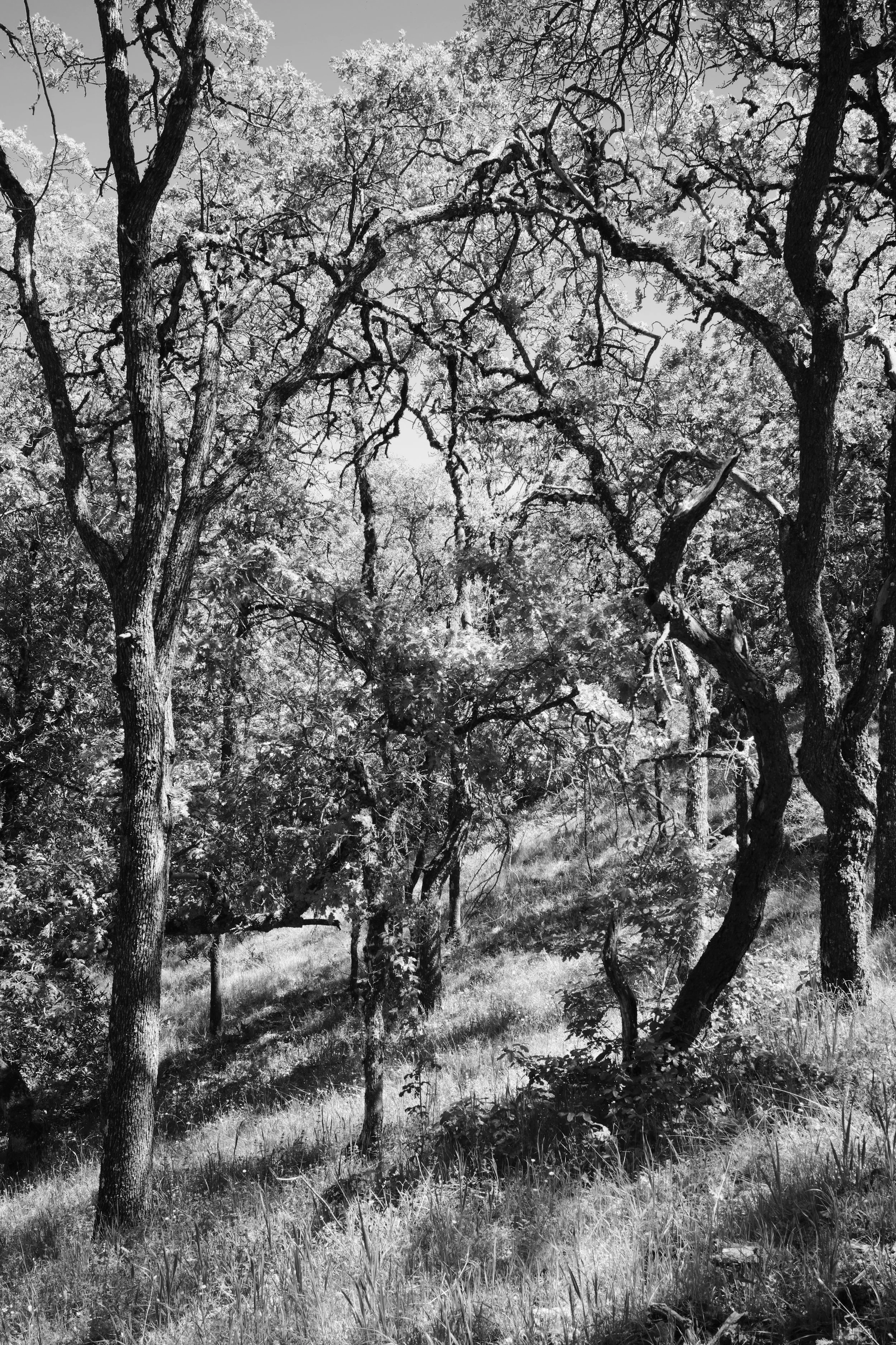
There was very little shade during the hike, with there being less than 10% shade coverage.
The Hunting Hollow Trailhead is a huge parking lot with space for dozens and dozens of cars. There is a $6 fee for parking and a $5 per night charge for backpackers. These fees can be paid in envelopes in the parking lot.
There were four portable toilets at the trailhead which were cleaned recently. The one on the far right had a working lock, while the largest one in the middle did not have a working lock.
There were two toilets we used on the trail. The first was located at the intersection of Wasno Road and Wagon Road, with the second at the outlet of Kelly Lake. Both bathrooms were clean and well stocked, but the one at Kelly Lake was very full. Both also had trash cans outside.
We only saw three hikers on the trail (and four cyclists) on the first day. Despite how beautiful the landscape is here, it is not a popular park.
Camp Review
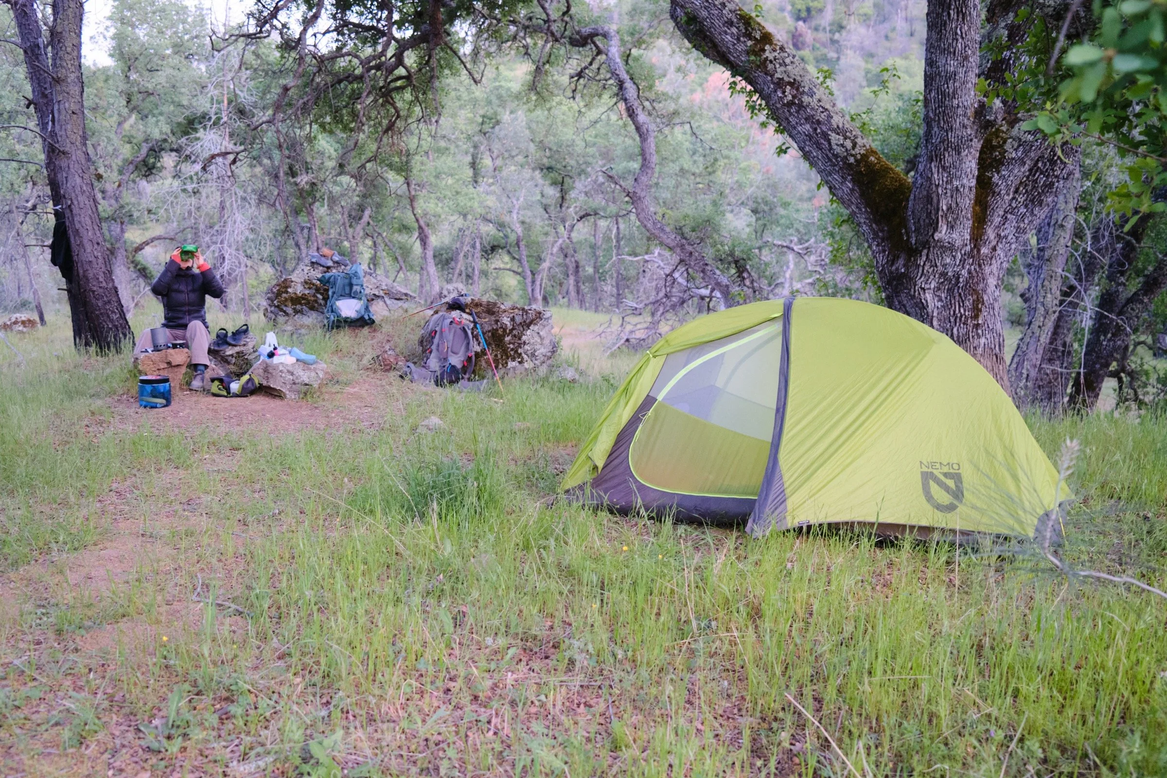
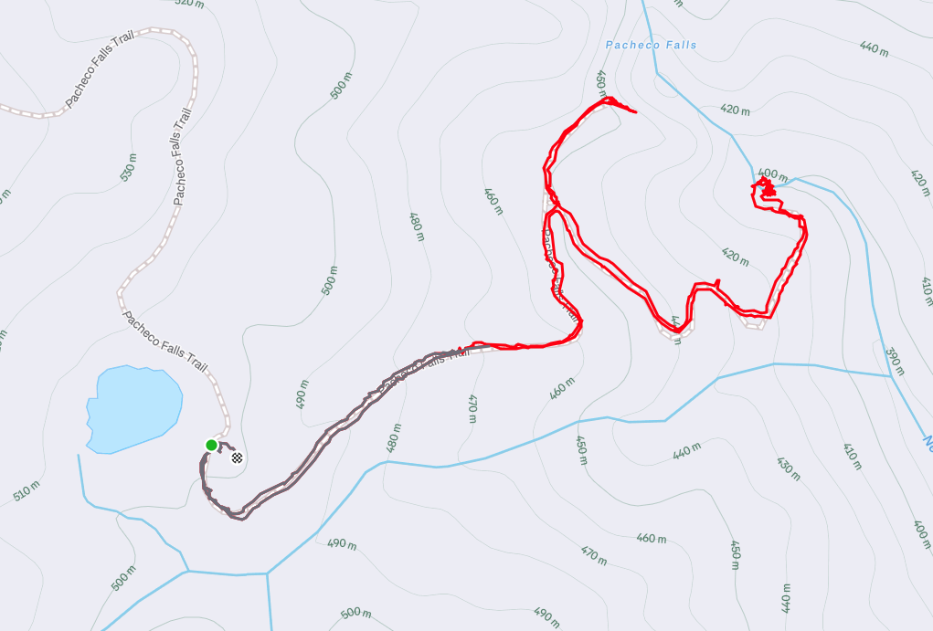
We camped at Wood Duck Pond, which is only half a mile away from Pacheco Falls.
The campspot we found was a wonderful spot that was protected from wind, had trees above the campsite to keep us warm, and some large rocks that served as our dinner table and seats.
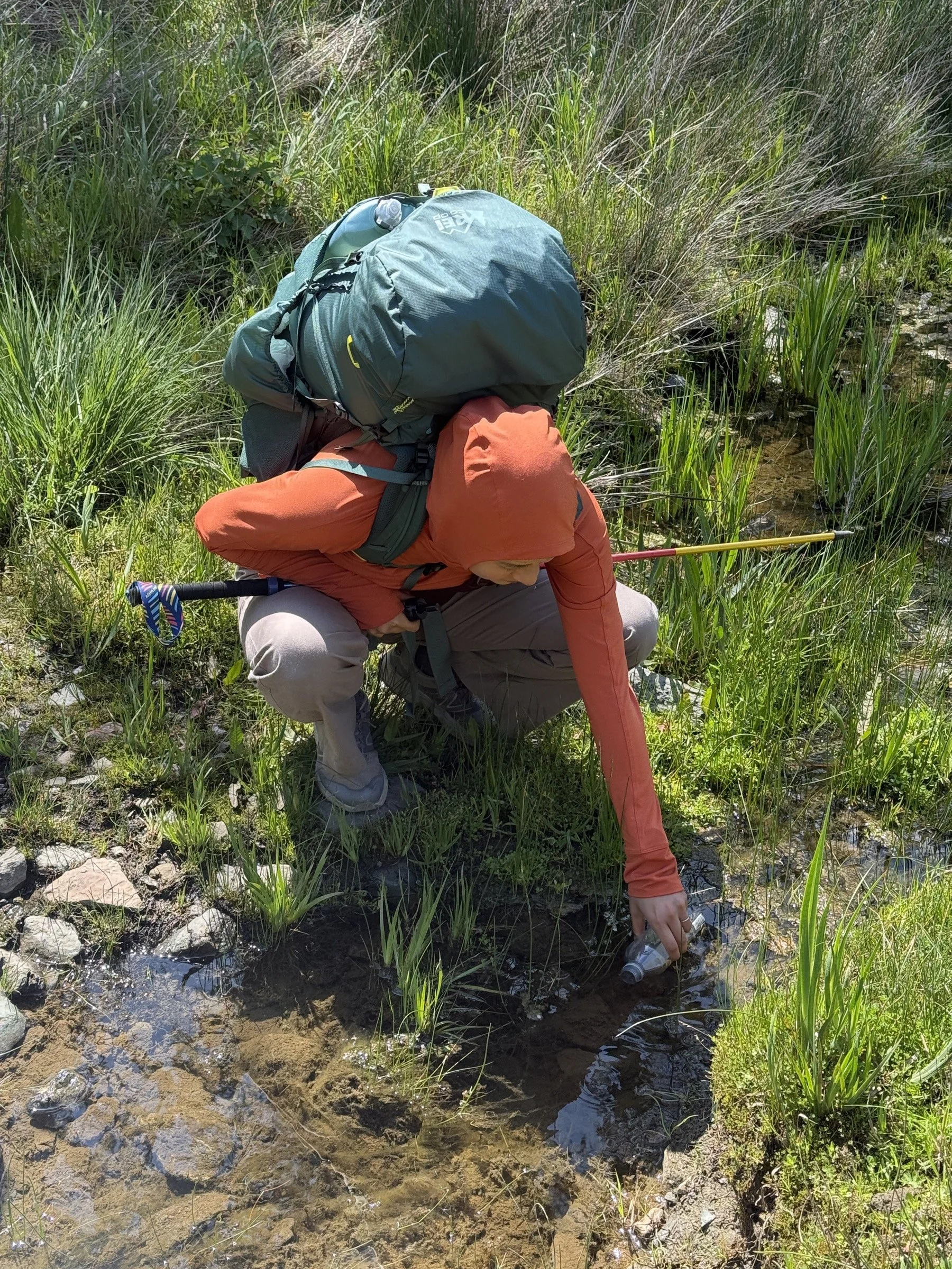
We took the water we needed for dinner from Wood Duck Pond. Because it’s a small, non-flowing pond, there were a ton of particles, insects, and tadpoles in the pond. Cassie did her best to get the least amount of stuff in the bottles, but even after filtering, the water was a bit yellow.


What I Learned
Jumping in water, after a long hike, is so worth it. The water will cool you down, and you’ll feel so much cleaner.
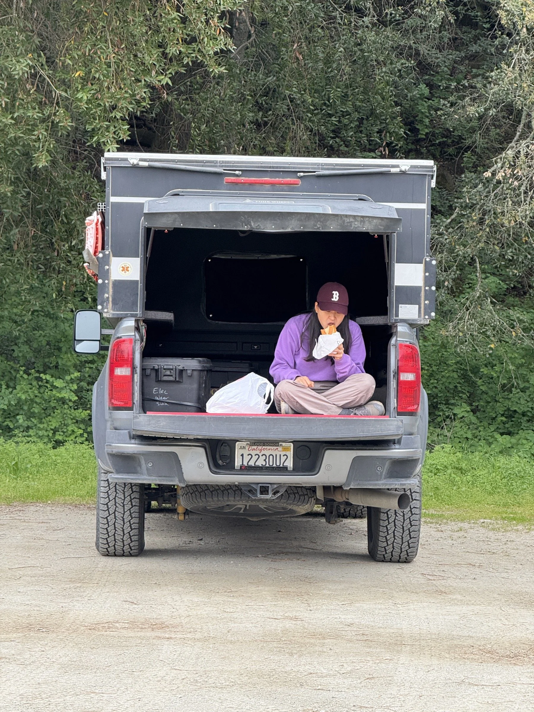
For a packed lunch, I think Banh Mi has overtaken Subway sandwiches as my favorite. We bought them on the way to the trailhead, and they were so yummy to eat on the trail.
We were pleasantly surprised at how nice and cool hiking the trails on ridges was. There was a nice breeze that cooled us down. So much so that after a 15-minute rest for lunch, we were both feeling cold.
After 4 hours of hiking in terrain surrounded by flowers and thus pollen, both of us started sniffling and dealing with congestion as we both succumbed to allergies. I felt better after jumping in the water and cooling down, then even better after I took my allergy medication after dinner. On the second day, however, I felt the allergies the whole day.
Cassie wanted to carry the food vs carrying the tent and ended up with the heaviest pack she had to carry to date. It was two pounds heavier than my pack (27 lbs vs 25 lbs)! Unfortunately, it led her to have a sore hip after 10 miles; so I ended up carrying a heavier load for the second day (28 lbs vs 22 lbs). With a lighter pack, Cassie felt better on the second day. It wasn’t perfect, but at least it did not get worse.
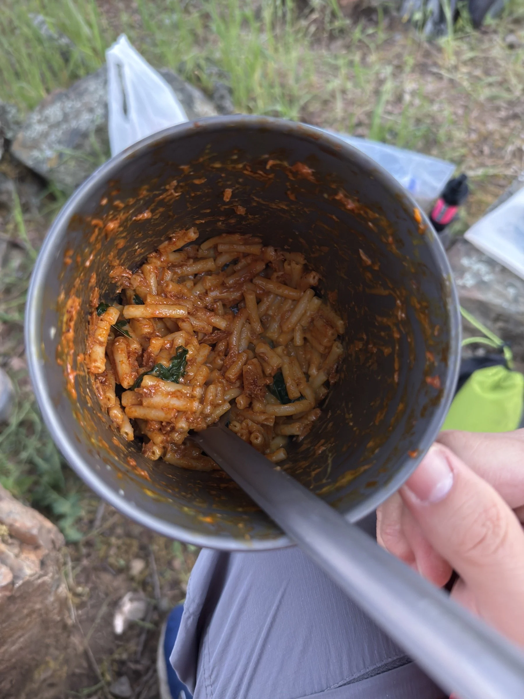
We cooked boxed Mac and Cheese for dinner. After it cooked, we added two slices of cheddar cheese, spinach, and a packet of chorizo-flavored tuna. The end result was around 1600 calories of deliciousness. Honestly, if there was one more box, I think we would have finished that too!
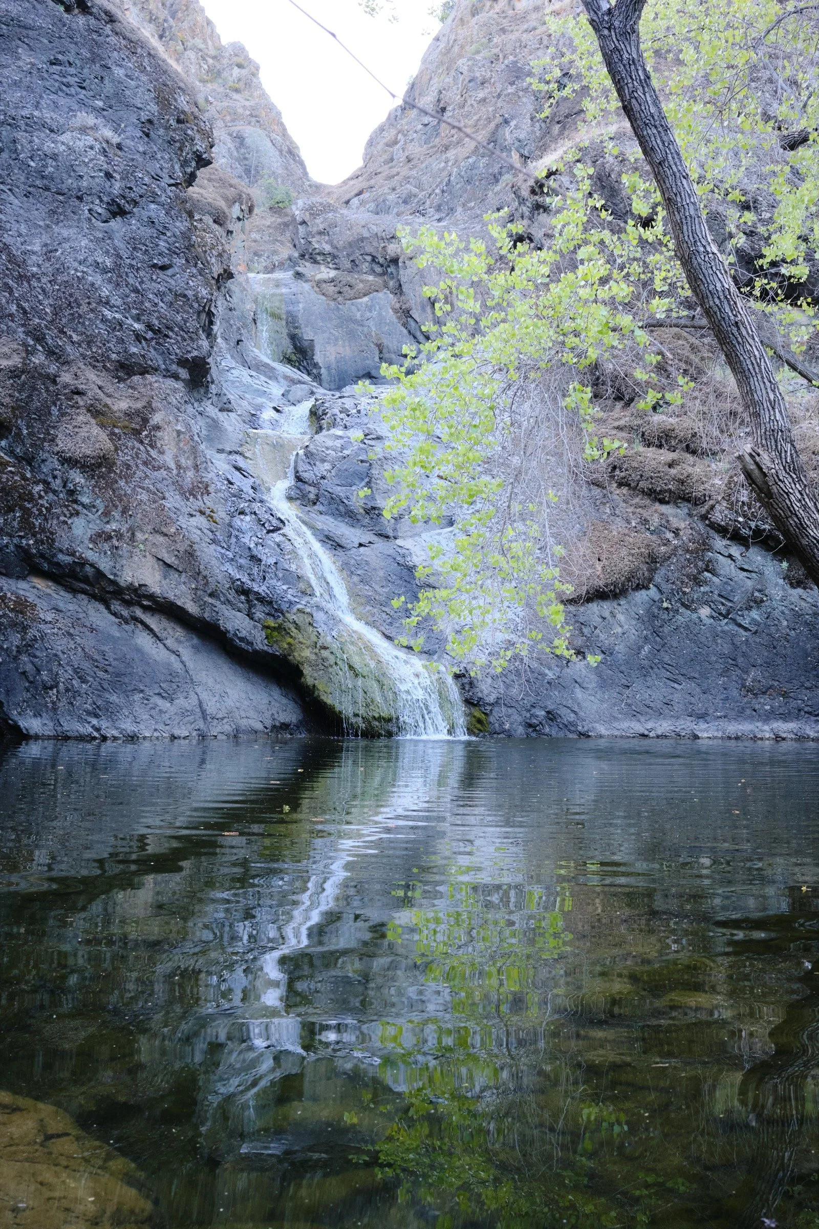
I read on AllTrails that the path to Pacheco Falls was blocked by a tree with poison oak growing all around it, preventing access to the falls. What I found out was that this was all over exaggerated. The access to the falls did have poison oak, but by walking carefully, one could access the water (and jump in) without touching poison oak. Cassie and I were glad that we went down to the falls to check it out as we would have skipped it if we had trusted AllTrails blindly. On the trail, we had a fellow hiker who said they had visited the falls this morning, who repeated what AllTrails had posted; I don’t think he went down to the falls trusting the online review.
I had also read about there being ticks, but we did not see any ticks on the trail. I hiked most of both days with shorts but did not get a tick on me. Lucky!
I was able to get a flock of turkeys to call back to me when I did a horrible imitation of a turkey call. Maybe I don’t need to buy a turkey call the next time I go hunting for turkeys.
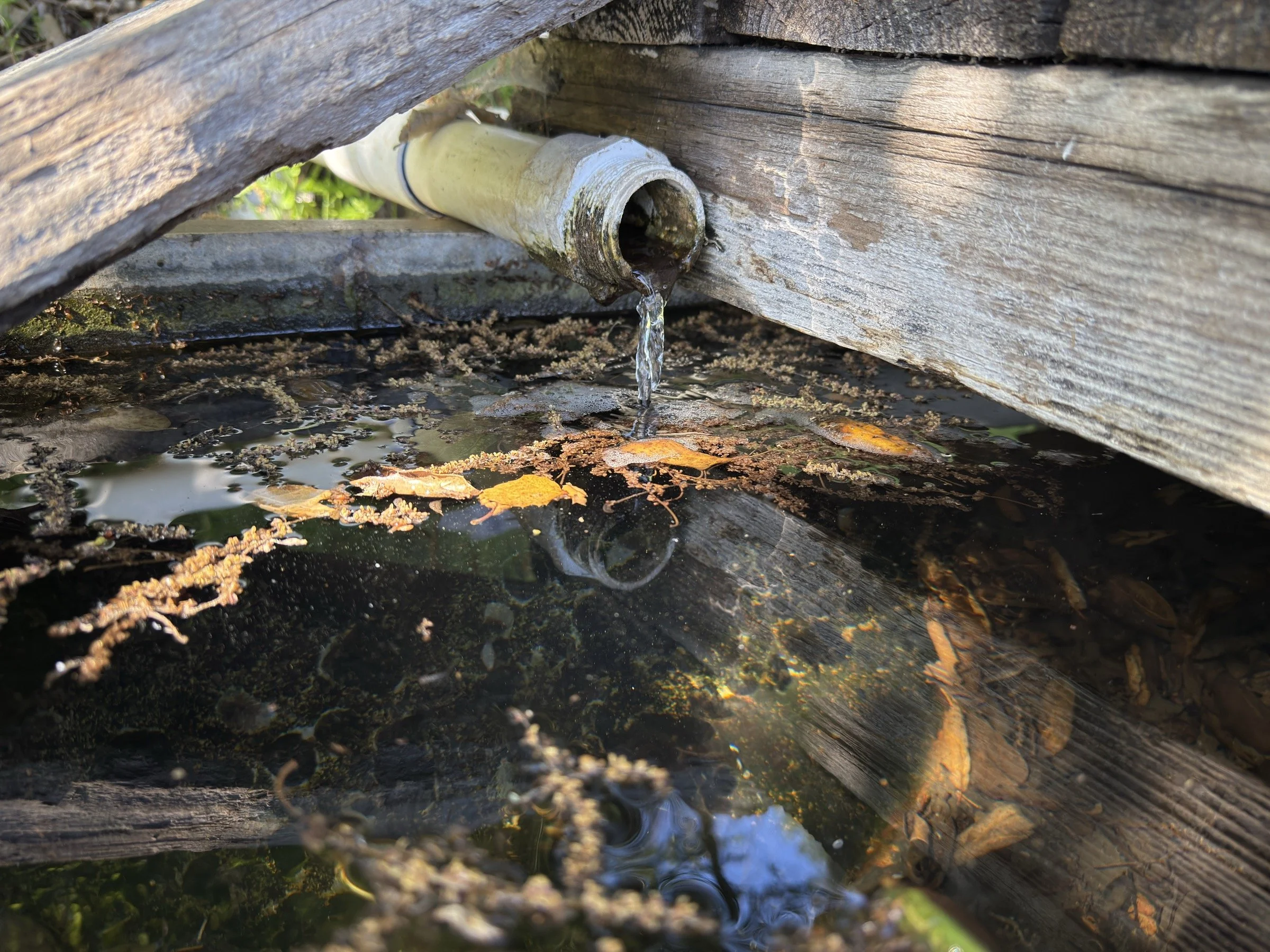
Spring water > lake water, at least at Henry Coe. While the filtered water tasted like matcha tea, the filtered water at Live Oak Springs tasted like pure water.
What Happened?
10.2 miles, 5 hrs 46 mins, 3150 ft of ascent
.9 miles, 1 hr 1 min, 358 ft of ascent

11 miles, 5 hrs 45 mins, 2300 ft of ascent
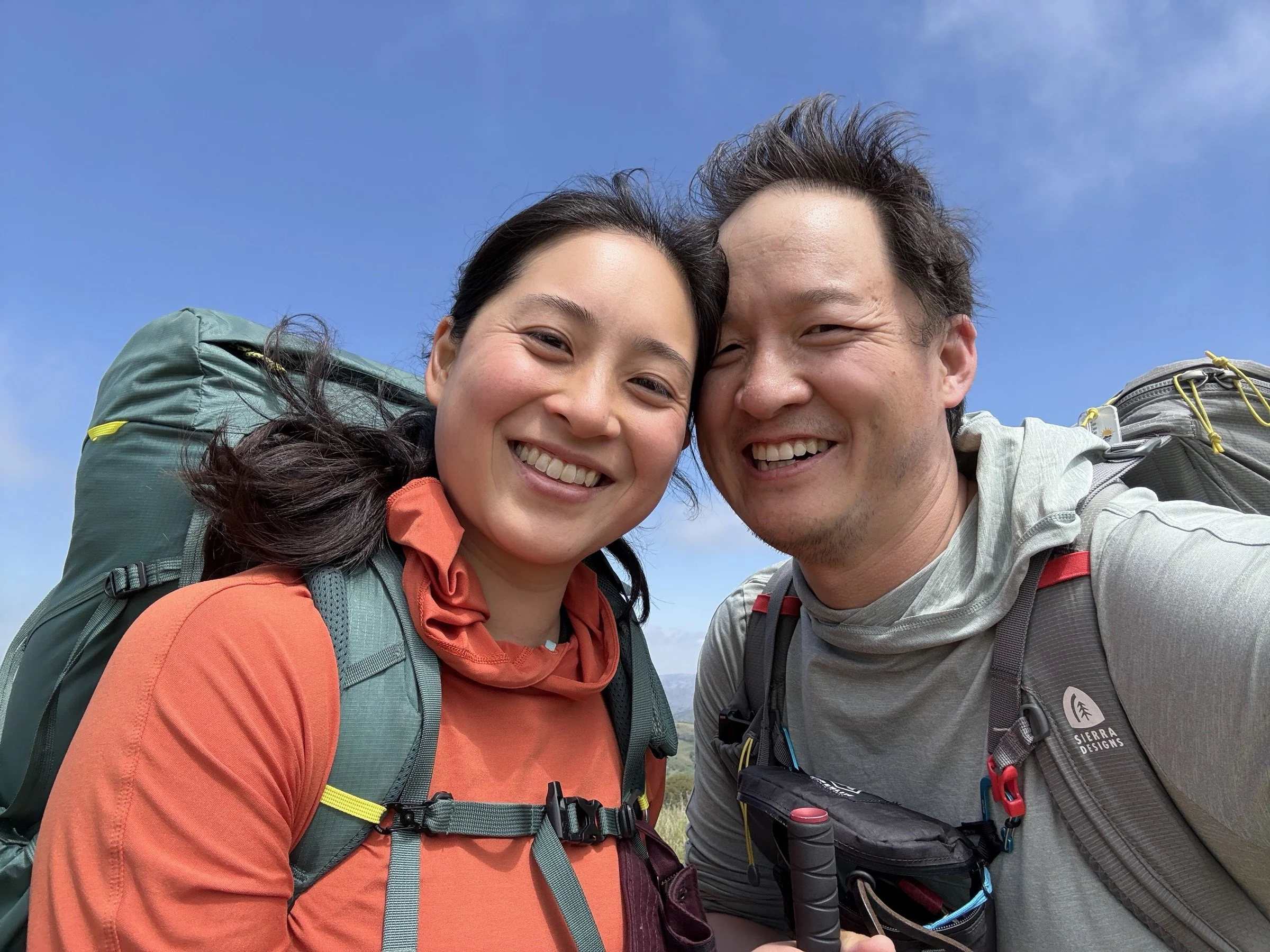
I had been eyeing Pacheco Falls for a few years, and with Cassie stating that her favorite outdoor activities from last year were backpacking ones, it was time to finally check out Pacheco Falls. Because it is located in the heart of Henry Coe State Park, it is a grueling 20-mile, 5000+ feet elevation gain hike over two days, but we were ready for the challenge.

The weather forecast had predicted a usually cool spring day, with the highs being in the mid-70s, so we started late in the day, getting to the parking lot at 11 a.m. We ate part of our lunch, paid the necessary fees, used the restroom, then started the hike.
We knew from looking at the maps that the first two miles would be the toughest—Steer Ridge Trail gains 1600 ft of elevation over two miles and, at least for me, felt like I was on a stair-master. I was tired and sweaty, but we made it up one step at a time. At the top, the view was commanding; there was a bench under a giant oak tree, so we took a break and ate our Banh Mi sandwiches.
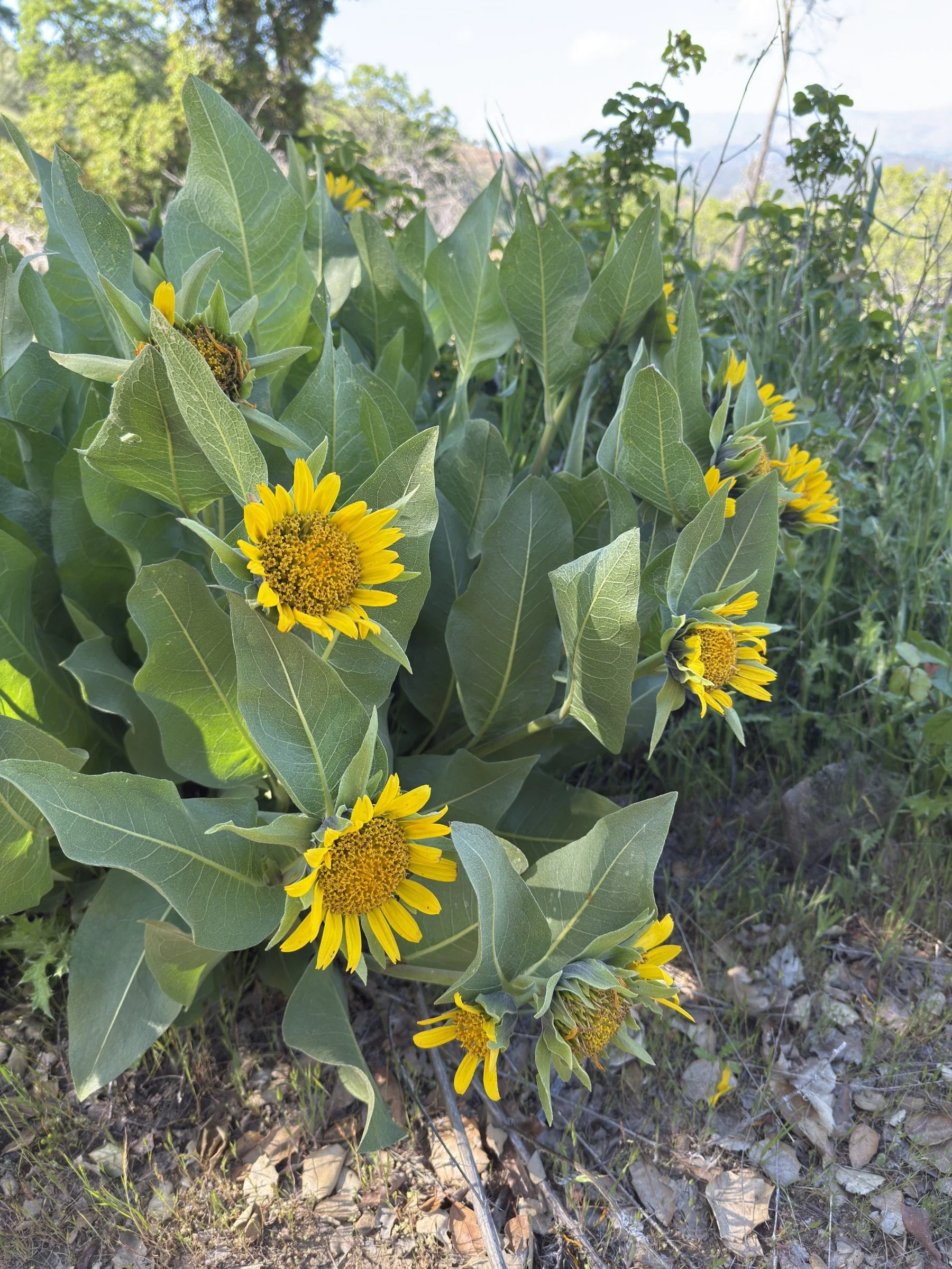
The hike from there to Wagon Road was quite pleasant. There were a ton of flowers; lots of trees and shade (compared to the rest of the day); and it was mostly downhill.
Wagon Road, however, wasn’t too bad. By this time, Cassie and I were both suffering from allergies, but the views on Wagon Road were still nice and we were glad that the road was not dusty at all.
When we made it down to Wood Duck Pond, we found a five-star spot for our tent, made camp, and then hiked down to Pacheco Falls, a little worried that we were hiking downhill in vain.
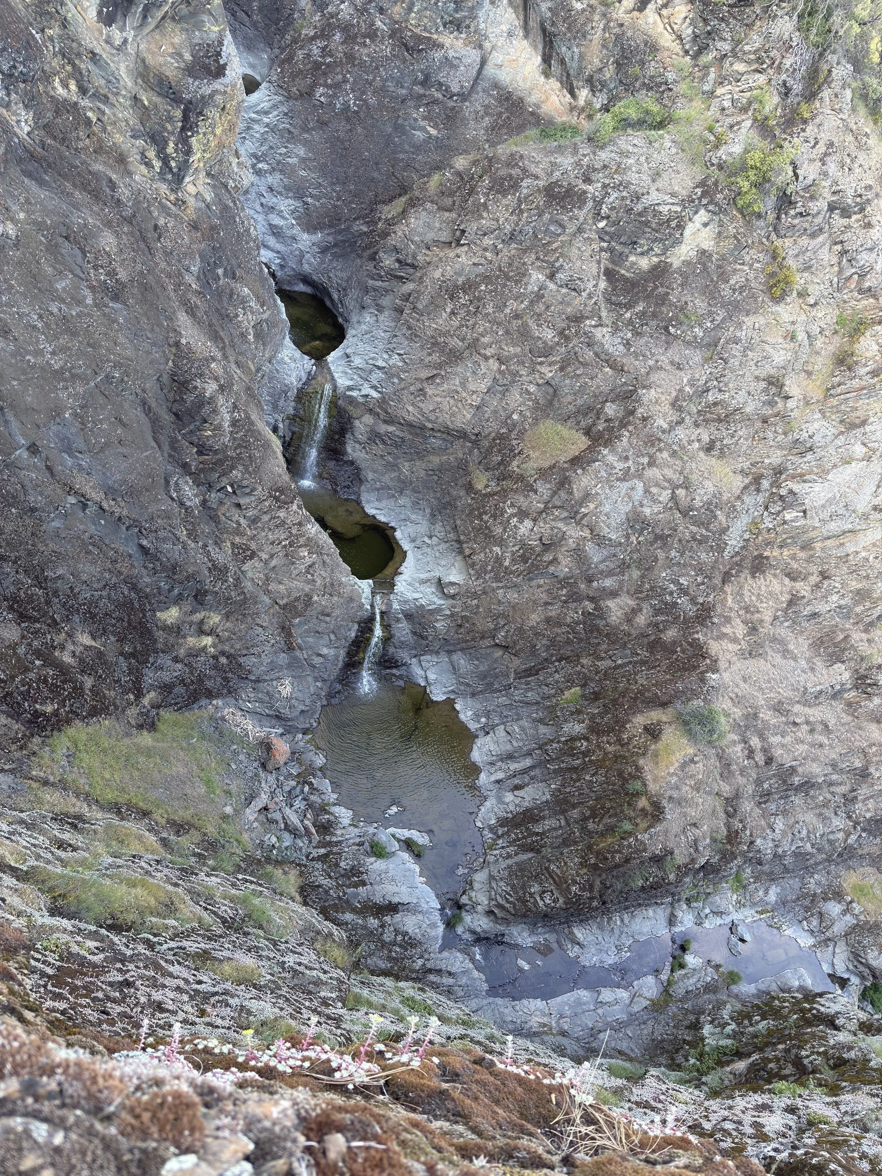
We first saw Pacheco Falls at an overlook, and the view down was fantastic. It turns out that behind Pacheco Falls looks like a canyoneer’s wet dream, with small falls leading to pools of water. It’d be awesome to run this canyon one day as I don’t think it is well known to the canyoneering community. We then hiked down further still worried about what we had read on AllTrails. Fortunately, we were able to jump in the water and enjoy all that Pacheco Falls could give us.
We then hiked back to camp, made an amazing dinner, then retired early as we were beat.
The next day, Cassie woke up first and went outside to paint while I slept in. We cleaned up camp around 9 a.m. and set off in a hurry (once we verified that we left nothing behind) as the fog slowly crept in from the north. We headed straight for Live Oak Springs to get yummier and cleaner water. After filling up, we headed to Kelly Lake.
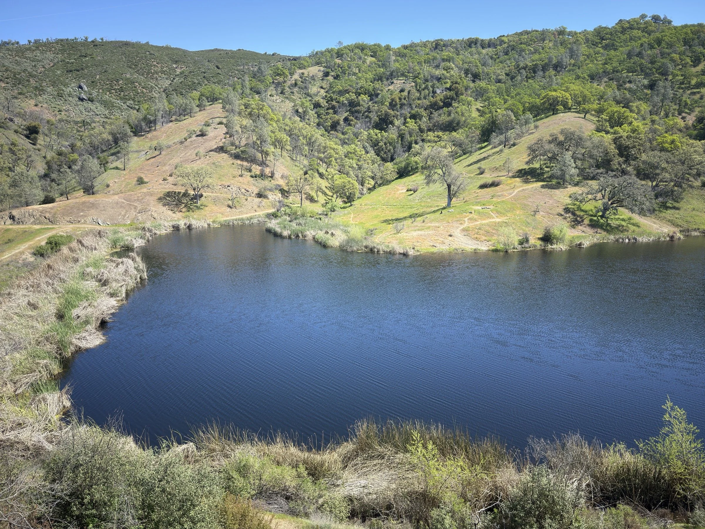
We took a wrong turn when we got to Wagon Road, but we quickly fixed our error in less than a quarter mile and headed back to Fish & Game Trail. The rest of the walk was uneventful and we arrived at Kelly Lake in good spirits.
From there, we headed uphill to Dexter Trail, which would be the high point of the day and it was great when we actually got to the high point instead of the dozens of false peaks we saw. I assumed that we would cruise from there, but we were slowed down by the steep and slippery trails on the way down to Gilroy Hot Springs Road.
When we got onto Gilroy Hot Springs Road, we had to walk another two miles, but it was a nice walk. There were hardly any cars and Coyote Creek kept us company with its burbles and super clear waters that we wanted to jump into.
We finally got back to the trailhead at around 2:30 p.m. and we immediately headed to a Mexican restaurant for chips, burritos, and a cold coke for me.