Castle Crags State Park

MVP
Running Shorts—Without it, I don’t make it up this trail because I would have overheated. If I overheated, the entire trip would have been a bust.
Hike Review:
Although I hiked on a hot day, the mostly shaded trail saved me from having to wear my hat or long-sleeve shirt.
The trail just gains elevation from the start with no let up. The last mile or so is especially tough.
There were bugs in areas that were fully shaded and not windy. I got bitten once.
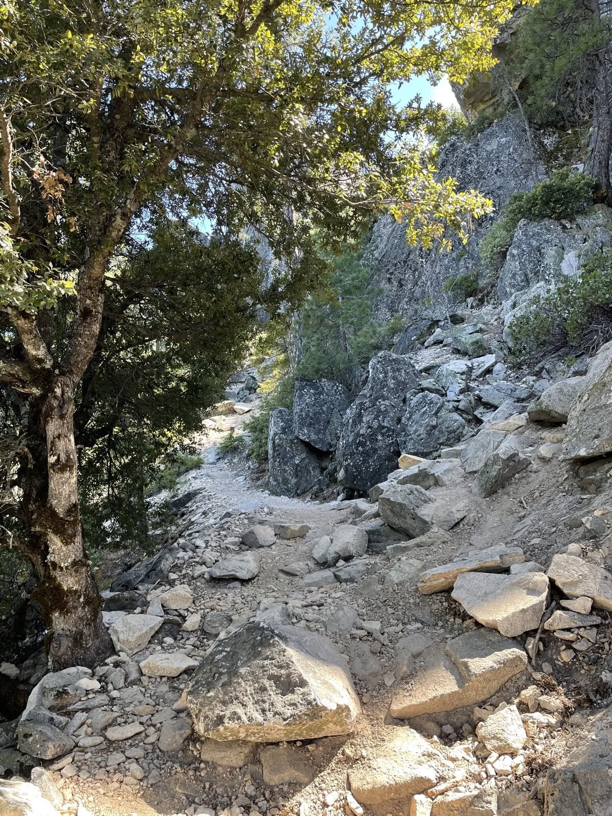
The trail gets a bit hard to follow at the end.
The first 80% of the trail is through a wooded forest and is gorgeous.


What I Learned:
When the Vista parking lot gets full, there’s only parking at the entrance, which adds 600+ ft of elevation gain and 3 miles to this already difficult trail.
I over packed clothing again.
My legs didn’t get tired until I reached almost the end of the trail, but I was overheating from the start. I put away the trekking poles and not using them allowed me to move my arms more and cool down more. They were, however, invaluable on the way down.
I bought my camera, but I was so tired at the top that I didn’t even take it out to take a picture. 1.5lbs carried for nothing.
At the tippy top, looking at Castle Dome, I got a bit of vertigo, so I started hiking down hill without exploring further. Another hiker told me that there was a Mount Shasta viewpoint through a cave or a hole in the rocks—maybe I’ll find it next time.
I hiked a very difficult trail in 82+ degrees F without suffering from overheating. I am very proud of my physical condition right now.
I brought jerky to eat on the trail, but I didn’t enjoy it as much as I thought I would. I’ll bring something else next time.
I forgot my airpods, which made this a miserable hike. I wasn’t able to quiet my anxious mind, so every step was a challenge. Still, I made it to the top.
What Happened?

8.5 miles, 4 hrs 16 mins, 2683 ft of ascent
When I arrived at Castle Crags State Park, I was told that the vista parking lot was full and that I would need to park by the entrance. The ranger recommended a few easy trails, but then when I asked him if I could still hike to the Castle Dome, he said that I looked to be in shape, so why not?
I parked, took off my convertible pants (I was wearing running shorts underneath), packed my hiking bag, and started the hike. The trail (Bob’s Hat Trail) starts off in a wonderfully green meadow, but the trail soon enters a heavily wooded forest and it stays that way for miles. During that time, regardless of the slope angle, the trail continuously gains elevation.
Bob’s Hat Trail starts off on a fire road, but then turns into a narrow trail that switchbacks up the mountain. By the time it meets up with the Crags Trail, it’s more of the same forest type setting (though drier than the lower elevations). With about a mile to go to the end of the trail, Crags Trail turns into a trail carved out on the sides of rocks. This is where the trail gets slippery as loose rocks are everywhere.
With about a quarter mile left to go, the rocks disappear for a bit and you walk on fine sand as you stare up at Castle Dome and Mount Hubris. I hiked up to the crag next to Castle Dome and took in it’s majesty, before experiencing a bit of vertigo feeling that scared me into walking down to a safer spot. I took a quick break on a rock to drink some water and chew on some jerky before heading down. Compared to the way up, I rather enjoyed the hike down, especially with the wind picking up.
When I got back to the trailhead, I enjoyed washing my head, face, arms, and legs, and headed off to a dinner with my brother and sister-in-law.