Cinder Cone
Hike Review:
I was mesmerized by the stark beauty of the Cinder Cone on the Lassen Volcanic National Park website, that I had to go see it for myself.
The trail is either loose sand or loose rocks, which makes for a more difficult hike than the miles and the elevation would make you suspect.
There is shade in the first mile and a quarter of the hike. Once one starts climbing the cone, however, there is zero shade.
There is tons of parking, but to get to the trailhead, you have to drive about 10 miles on unpaved road. It is mostly washboard, so it wasn’t pleasant.
What I Learned:
Loose rocks is just a difficult surface to hike. Every three steps up, I would slide back a full step’s worth of distance. Fortunately, the slipper part of the climb was only about 500ft in elevation.
Media Consumed:
The Murder of Roger Ackroyd
What Happened?
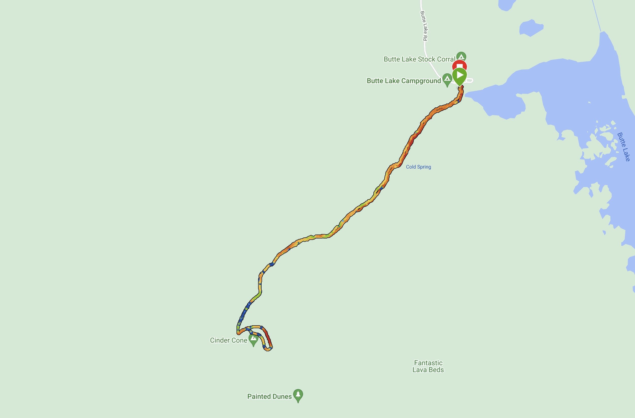
3.9 miles, 1 hrs 53 mins, 865 ft of ascent
I hadn’t planned on hiking Cinder Cone, but I had finished my first two hikes of the day earlier than expected, so I decided to just go for a third hike, since it would be a good way to test my physical fitness.
I got to the trailhead about two hours before sunset and started hiking in a hurry. I initially made great progress, but once I got to the Cinder Cone and started hiking that, I felt tired, especially given the challenging terrain. I eventually got to the top of the cone, and walked to the opposite side of where I had hiked up. I chose not to go down to the cone itself, as I was tired and just wanted to find a campsite before it was completely dark.
I hiked down the mountain in a hurry and got a ton of rocks in my shoes. My legs felt fatigued with about a mile to go, but given my long day, I think it made sense.
I got in my car, and headed off near the north entrance of Lassen, as I had marked down a spot where I could camp. However, while driving from Cinder Cone, I spotted at least a dozen places I could camp in Lassen National Forest.


