Henry Coe State Park - Mt Sizer
MVP
Carhartt’s All Terrain Boot Socks—I think it’s crazy that after 18 miles in hot weather (with a swim in the middle of it), I didn’t get blisters. I love these socks.
Hike Review:
The more than half of the trails I walked today were actually dusty roads. There were parts where the dust was so deep that no matter how careful I was, my socks were just covered in dust.
There were only a few stretches where there was zero shade. Which was really nice, as I used it as quick rest stops when I felt overheated.
Whoever designed the trails at Henry Coe was not a fan of switchbacks. The trails are super steep, so trekking poles are a must.
The Narrows trail was almost completely dry. I think this trail would be really fun in April, when there’s running water and the trail crisscrosses the creek multiple times.
I liked how there were water sources on the trail so that I didn’t have to carry tons of water. I refilled at Sada’s Spring and at China Hole.
What I Learned:

I found my easy/fun hiking limit, which is about 14 miles. Or at least around the 14 mile mark (around 2400 ascent at that point), I started feeling fatigued. My right hip started feeling uncomfortable. Around the 16 mile point, for about a mile, I felt great, but it was a mirage as even heavier fatigue set-in after. Thinking back, I should have taken a deeper rest at China Hole (I swam and sat for about 30 min). I think that would have helped me stay fresh.
I would have hiked at a faster pace at the beginning, but the steep trail (especially going down) really slowed me down.
I should have started hiking an hour earlier, as it would have let me avoid the highest temperature during the day.
I packed Kim Bap for breakfast, and while it took a while to roll and cut and pack, it was worth it. I can’t imagine a better breakfast that carries so well.
I’m not going to carry the camera next time I do another 12+mile hike. After about the first 8 miles, I got tired of carrying it on my chest and put it away in my backpack for good.
I wore my running shorts, which kept me cool and allowed me to swim without changing. Just awesome!
I carried a quick-dry towel and I really liked using it to soak up sweat, dry myself after swimming, cool my neck, clean my feet, etc.
What Happened?

18.3 miles, 9 hrs 35 mins, 3836 ft of ascent
I woke up at 4:30am and got to the trailhead at 6:15am, about an hour past the start time I really wanted. After paying the parking fee ($8), I started on my way to Mt Sizer. I found it slightly chilly given the temperature (~56 F) and my clothing (running shorts + t-shirt), but after about 1/2 a mile, I found it to be very comfortable.
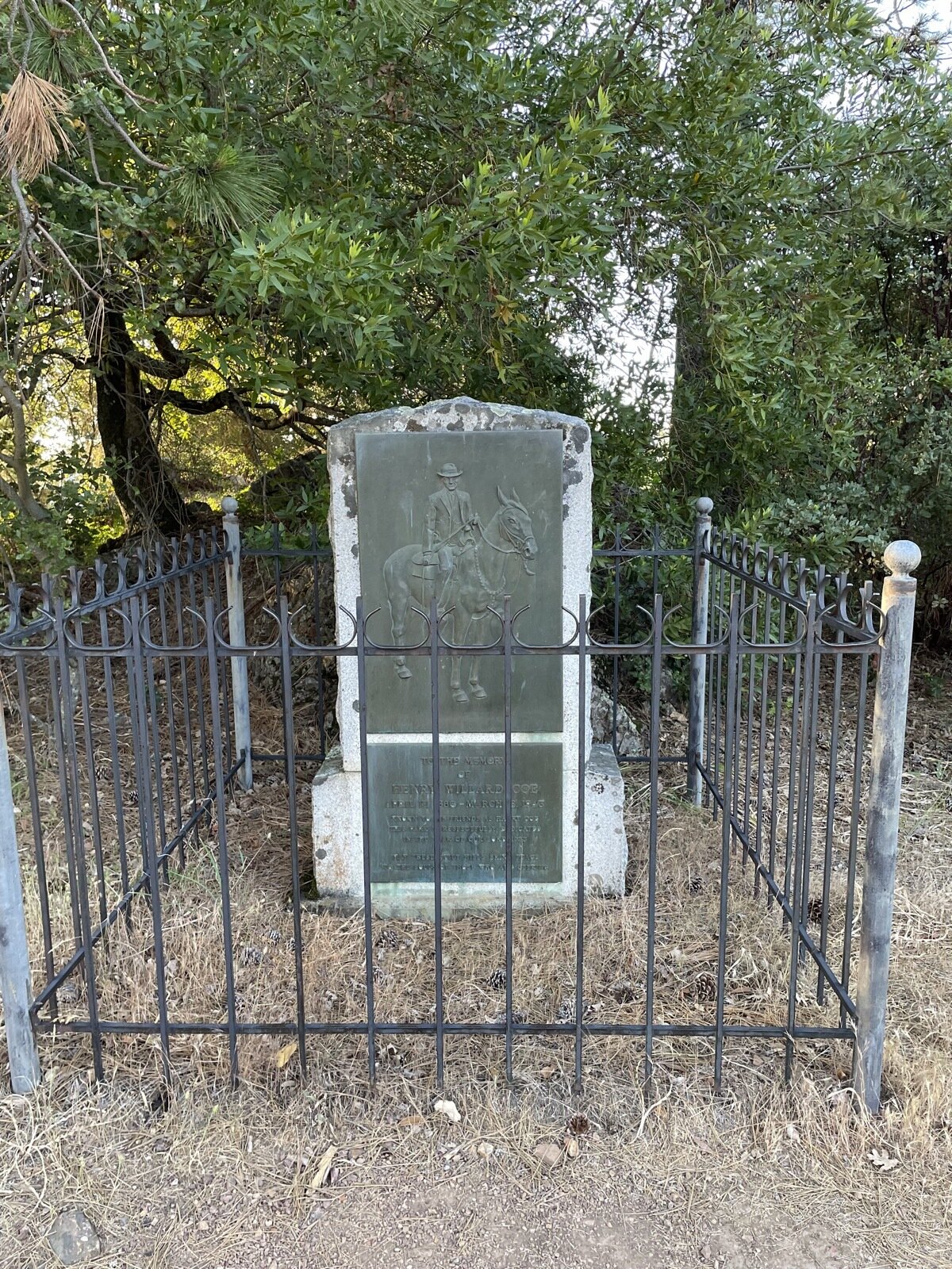
My first point of interest was the Henry Coe Monument, which I found to be underwhelming. It just wasn’t much to look at. I guess I had imagined something grander or prettier. I made good progress and made it to Frog Lake—it was surprisingly full. I had expected the lake to be under capacity.
I then climbed up Middle Ridge, where I found Blue Ridge looking down on me. It was all downhill to Middle Fork Coyote Creek, which I crossed, then started the climb up Blue Ridge. I read somewhere that this climb is one of the toughest in the Bay Area, as the trail gains almost 1500’ of elevation in 1.3 miles. Not only that, the trail doesn’t have much in the way of switchbacks, instead it’s just a super steep trail. I took many short breaks on this climb, but made it to the top no worse for wear. I felt really good at the top.
At this point, I was about 5 or 6 miles in, and even though it was only about 9 or so, the temperature started heating up. I would estimate that it was probably only about 65 degrees max, but I definitely started sweating.
The walk to Mt Sizer was a bit boring, really, and I found the Blue Ridge Road to be the second least favorite part of the hike. The road was so dusty that in some spots, my feet would sink into this pillowy layer of dust, which would coat my socks, shoes, and legs in fine powder. At the top of Mt Sizer, I was hoping that I would find a log book or something of interest, but there was none, so I kept going.
The next point of interest for me was Los Cruzeros Camp, which took a while to get to. The path to there was on Blue Ridge Road, which made the walk that much more tiresome. I suppose the one upside of there being so much fine dust is that I did get to see lots of different footprints from many different animals.
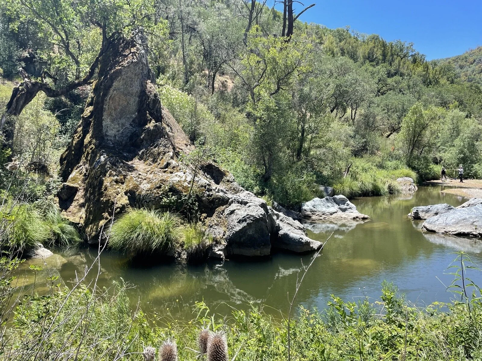
At Los Cruzeros Camp, I found zero tents or people, which wasn’t surprising given that the East Fork Coyote Creek was dry (except for a few pools of water). I was hoping that this week would still be flowing, so I was a bit disappointed (I had brought my sandals for this part). Still, I walked down The Narrows trail, and I’m definitely going to come back to this part of the trail next year, as I think it’d be a really fun trail to walk, with multiple water crossings and interesting rock formations.
The Narrows trail exited me on to China Hole, which was an oasis in the middle of so much dryness. This is where I also saw people, as up to this point, I had only passed two hikers in the first mile of walking. There must have been around 20 people around China Hole, but at least when I got there, no one else was swimming, which blew my mind, as it was so hot (it was around 12:30pm or so when I got there, so maybe 80 F?). I took my shoes, socks, and shirt off and jumped in. It felt so damn good. So damn good that I jumped in twice more.
I made a mistake here, which is that I didn’t rest too long—I didn’t see any great spots under the shade to just rest and relax. I dried myself, put back on my shirt, socks, and shoes, and filled my empty water bottle with water from China Hole, then started the last 6 miles of my hike back to my car.
The first mile climbing up felt great, but right around the 14 mile point was when I felt fatigue. It was so hot (85 F) and my right leg joint started to hurt a little bit. Worse, I was among short manzanita trees that offered no substantial shade for me to rest at, so I just kept going.
I took a 5 minute break at the Manzanita Point Group Camp, and I wished I could stay longer, but bugs were starting to bite, so I pushed on. It’s funny that the rest of the hike to the car was the most difficult of the hike, but I don’t remember much about it.
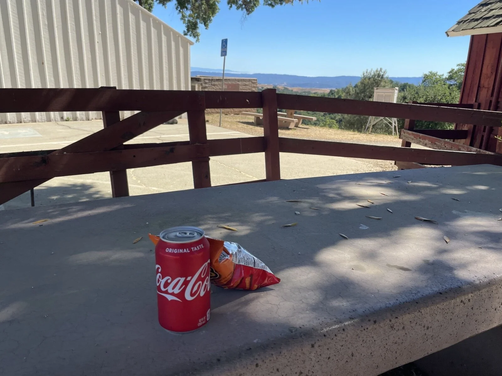
Once I got back to the car, I grabbed some cash and my face mask and went into the visitor center to get my cola that I had been dreaming about for most of the hike. I enjoyed the cola with some Cheetos under a tree and felt glorious that I was a more capable person than I had previously known.