Mission and Monument Peak
Hike Review
I hiked from Sunol Wilderness Regional Preserve up to Monument Peak, then bagged Mission Peak on the way back.
The hike from Sunol up to Eagle Spring Backpack Camp was beautiful, and I was surprised there was so much shade (probably 30% coverage) compared to the Stanford Ave path, which has basically zero shade. The views were beautiful, and there were a very few souls on the trail. However, because it had rained the previous few days, the trail was slick, and my running shoes were not up to the task of keeping me feeling confident.
The trail from Eagle Spring Backpack Camp to Monument Peak had almost zero people on it (I think I passed three people over 4 miles or so). The rolling hills were especially beautiful due to the big fluffy clouds that gave splashes of shade and contrast to the landscape. There was zero shade, except for what the clouds could lend for a few minutes at a time. I then walked back after tagging Monument Peak but walked through Mission Peak just to bag the peak. There were so many people on Mission Peak, as usual.


What I Learned
I thought it was still winter and didn’t wear sunscreen. I got sunburned. :/
My hips didn’t complain too much, and I was happy with my overall fitness. I think it’s the biking I’ve done over the winter that has kept me able to do stuff like this without perishing.
I drank a ton of water even though it wasn’t too hot. I drank about half a liter of water on the way to the hike, and I consumed about 2 liters of water on the hike itself (with a liter having been mixed with an electrolyte mix). I ended up peeing three or four times on the side of the trail.
I saw a ton of wildlife. I saw a ton of squirrels on the hike between the peaks; I saw a horse carcass that had long been scavenged, though the skeleton itself did not look too old to me; I saw half a dozen vultures as they were hanging out on a tree right next to the trail; and the coolest was this beautiful coyote that was hanging out in the shadows of Mission Peak.
There were a few trails that looked good on the map, but in person were either closed to people or there was a gate with a lock on it. I was disappointed that I was not able to explore more of the park.

Media Consumed
All the Pretty Horses—finished!
Demon Copperhead


What Happened?

14.8 miles, 5 hr 54 mins, 3940 ft of ascent

Cassie was out of town, and I had plans to hike in Pinnacles, but that plan got cancelled, so I looked around for something closer. There are a ton of hikes in the Bay Area, but I wanted to use this opportunity to complete something that I had long looked forward to.
I had wanted to hike to the top of Monument Peak since a few years ago, and when I tried a few years ago, I found the trail from Ed Levin County Park to be less than inspiring with lots of cow dung and steep trails that would be slick after rain. But I realized while looking at the map that I could get there from Mission Peak, and since I had also wanted to hike up to Mission Peak from Sunol, I put the two together and made it one long hike.
I got to Sunol Wilderness Regional Preserve at around 10a.m. I it was a hazy day—I welcomed it as it would keep the air cooler as I hiked up. I passed a few people on the way up, but I was pretty focused on keeping a good pace, so I just said my hellos (if they made eye contact) and kept on moving.
I was listening to a fantastic book, All the Pretty Horses by Cormac McCarthy, so the miles just seemed to come and go, and half my mind was in Mexico. Or at least dreaming of a desert landscape and settling for gentle green hills.

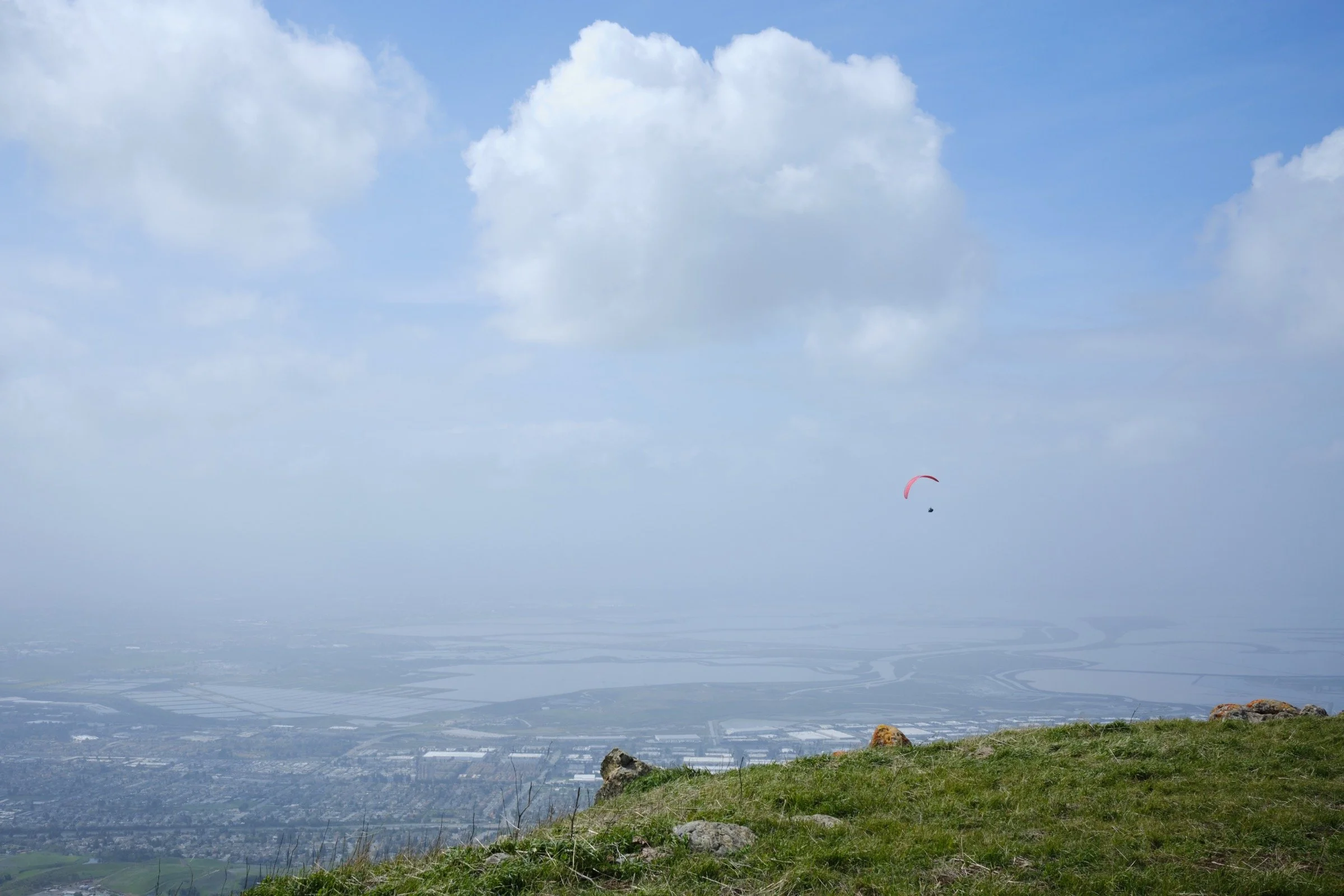
When I got up to Monument Peak, I walked around the top some and enjoyed watching the paragliders with wonder. It was amazing to see them gain altitude while lazily circling overhead. I did also stop by the Monument Peak North on the way back because… why not? It only cost me a quarter mile or so of hiking. I did not, however, hike up Mount Allison, as it is on private property and I did not want to trespass (I did also think that it looked like an evil place to be, with all the radio towers lending menace to a gentle mountain).
I then made it up to Mission Peak for my third peak of the day, then hiked back down the north side, before turning east and tracing my steps down to Sunol. Lastly, I found Eagle Spring Backpack Camp (located directly east of Mission Peak) to be small, exposed, and not-too-cozy. I reckon it’s some people’s first backpack camp, but with the hike that’s required, lack of shade, and too many people looking down from Mission Peak, I don’t think I’ll be going there anytime soon. For those who are going, please note that there is running water at the camp, but that it is not potable!
Despite the many patches of slick mud that almost made me fall a dozen times, I was astounded by how beautiful the landscape was. Perhaps it would not have been so eye-popping without the clouds, but I sure was glad to have hiked on this day.


